GeoListPlot
GeoListPlot[{loc1,loc2,…}]
产生显示地点 loci 的地图.
GeoListPlot[{list1,list2,…}]
产生显示一些地点列表的地图.
更多信息和选项


- 可用以下形式给出地理位置 loci:
-
GeoPosition[{lat,lon}] 经度和维度 Entity[…] 地理实体 Dated[ent,date] 有日期的实体 GeoGroup[{…}] 一组实体 Polygon,GeoDisk,… 地理区域 - 可用以下形式给出多个位置 locs:
-
{loc1,loc2,…} 位置列表 GeoPosition[{pos1,pos2,…}] 地理位置数组 EntityClass[…] 地理实体类别 - 可用以下形式给出 GeoListPlot 的数据 datai:
-
{e1,e2,…} 元素列表,可带有封装,也可以不带有封装 <k1e1,k2e2,…> 键与值构成的关联 WeightedData[…] 带有权重的位置 w[{e1,e2,…},…] 应用于整个数据集的封装 w[{data1,data1,…},…] 应用于所有数据集的封装 - 可将以下封装用于地图元素:
-
Annotation[e,label] 提供注释 Button[e,action] 定义元素被点击时执行的操作 EventHandler[e,…] 为元素定义通用事件处理程序 Hyperlink[e,uri] 将元素变成超链接 Labeled[e,…] 显示元素时同时显示标签 Legended[e,…] 在图例中包括元素的特点 PopupWindow[e,cont] 为元素添加弹出窗口 StatusArea[e,label] 鼠标悬停时在状态栏中显示 Style[e,opts] 用指定样式显示元素 Tooltip[e,label] 为元素添加提示条 - 绘图时将忽略不是以这些形式给出的数据.
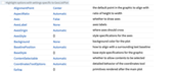
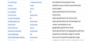
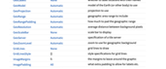
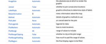
- GeoListPlot 与 GeoGraphics 具有相同选项,并且有下列添加和改动: [所有选项的列表]
-
GeoLabels None 是否用名称对地点添加标签 Joined False 是否连接相邻地点 LabelStyle Automatic 决定标签样式的图形指令 PlotLegends Automatic 数据的图例 PlotMarkers Automatic 如何标记地点 PlotStyle Automatic 决定 loci 样式的图形指令 - 可以使用 GeoLabels 的下列设置:
-
Automatic 对图形输出添加文本标签 None 不添加标签 func 应用函数 func - PlotMarkers 可接受以下形式:
-
Automatic 自动选择绘图标记 Polygon 使用多边形 Point 使用点 GeoMarker 使用地理标记 "OpenMarkers" 空心形状 g 由表达式 g 的拷贝组成标记 {g,s} 大小为 s 的表达式 g {Automatic,spec} 自动选择标记,备用标记为 spec {Polygon,spec} 使用多边形,备用标记为 spec {spec1,spec2,…} data1、data2、… 的绘图标记指定 - 如果设置 PlotMarkers -> Automatic,用多边形来显示实体区域. 如果多边形与整个地图相比太小,或者没有可用的多边形,将用点代替.
- 提供给 GeoLabels 中函数的参数有 graphicsi、regi 和 EntityValue[regi,"Position"],其中 graphicsi 是 Graphics 或 GeoGraphics 对象用于标记 regi,默认是 Point 或 Polygon.
所有选项的列表


范例
打开所有单元关闭所有单元范围 (5)
GeoListPlot 可用于大多数地理实体和 GeoPosition:
GeoListPlot 作用于添加记号的地点:
GeoListPlot 可用于 TemporalData、TimeSeries 和 EventSeries,比如哥伦布第一次航行的主要登陆地点:
选项 (13)
Joined (3)
LabelStyle (2)
PlotMarkers (3)
应用 (1)
绘制由 EventSeries 给出的强震位置:
属性和关系 (8)
通过 GeoBubbleChart 用缩放过的气泡显示值:
通过 GeoRegionValuePlot 用着色区域显示值:
用 GeoHistogram 对位置进行汇总:
用 GeoSmoothHistogram 生成位置的平滑密度图:
用 GeoVectorPlot 和 GeoStreamPlot 绘制向量场:
用 GeoContourPlot 在地图上绘制等值线:
用颜色和 GeoDensityPlot 对地图进行平滑着色:
巧妙范例 (2)
文本
Wolfram Research (2014),GeoListPlot,Wolfram 语言函数,https://reference.wolfram.com/language/ref/GeoListPlot.html.
CMS
Wolfram 语言. 2014. "GeoListPlot." Wolfram 语言与系统参考资料中心. Wolfram Research. https://reference.wolfram.com/language/ref/GeoListPlot.html.
APA
Wolfram 语言. (2014). GeoListPlot. Wolfram 语言与系统参考资料中心. 追溯自 https://reference.wolfram.com/language/ref/GeoListPlot.html 年